The AGCS uses Mavlink and STANAG 4586 type messages to cover the flow of all the important procedures and parameters between airborne aircraft and ground control segment. Considering above facts, the GCS software layout flexibility allows for implementation in Mini, Tactical or even Male class UAV platforms.
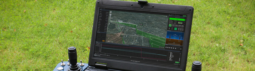
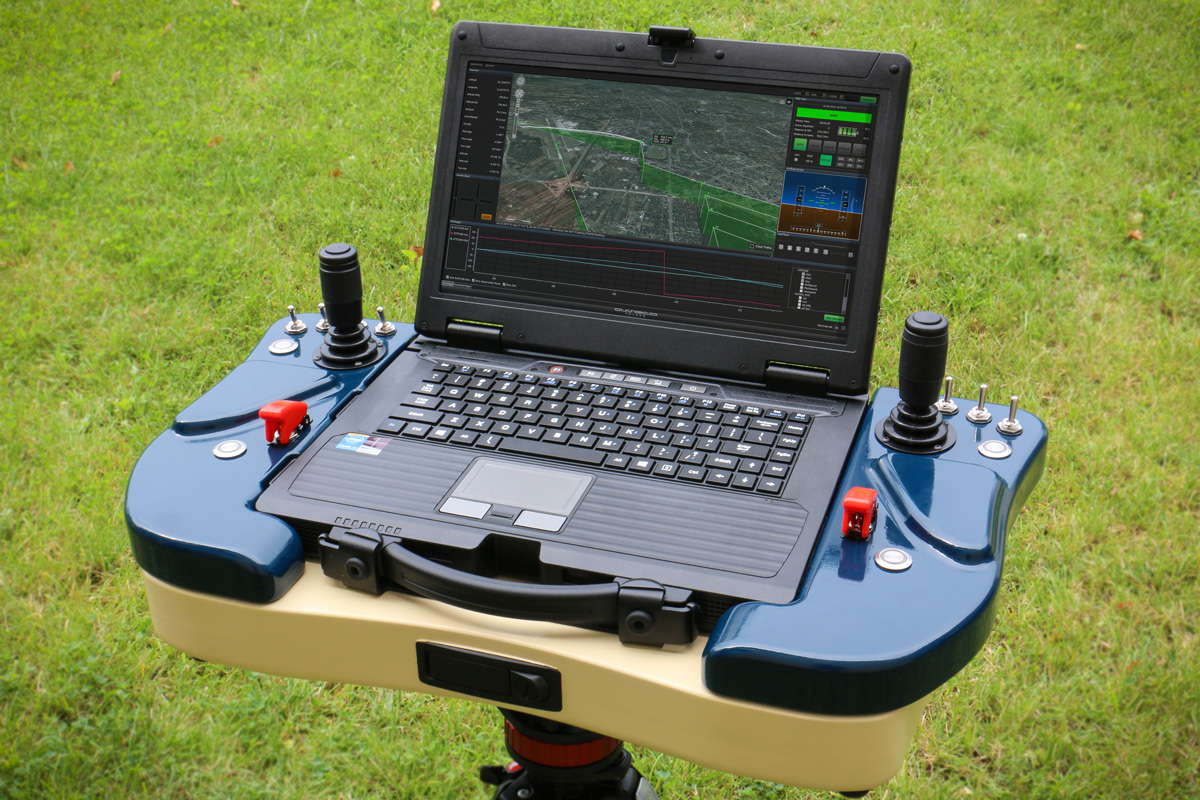
Application modular architecture allows for intuitive and easy layout modification with use of dedicated logging and user verification module. Ground control station allows for simultaneous three unmanned platform operation. GCS software includes build-in map module allowing for flexible worldwide operation.
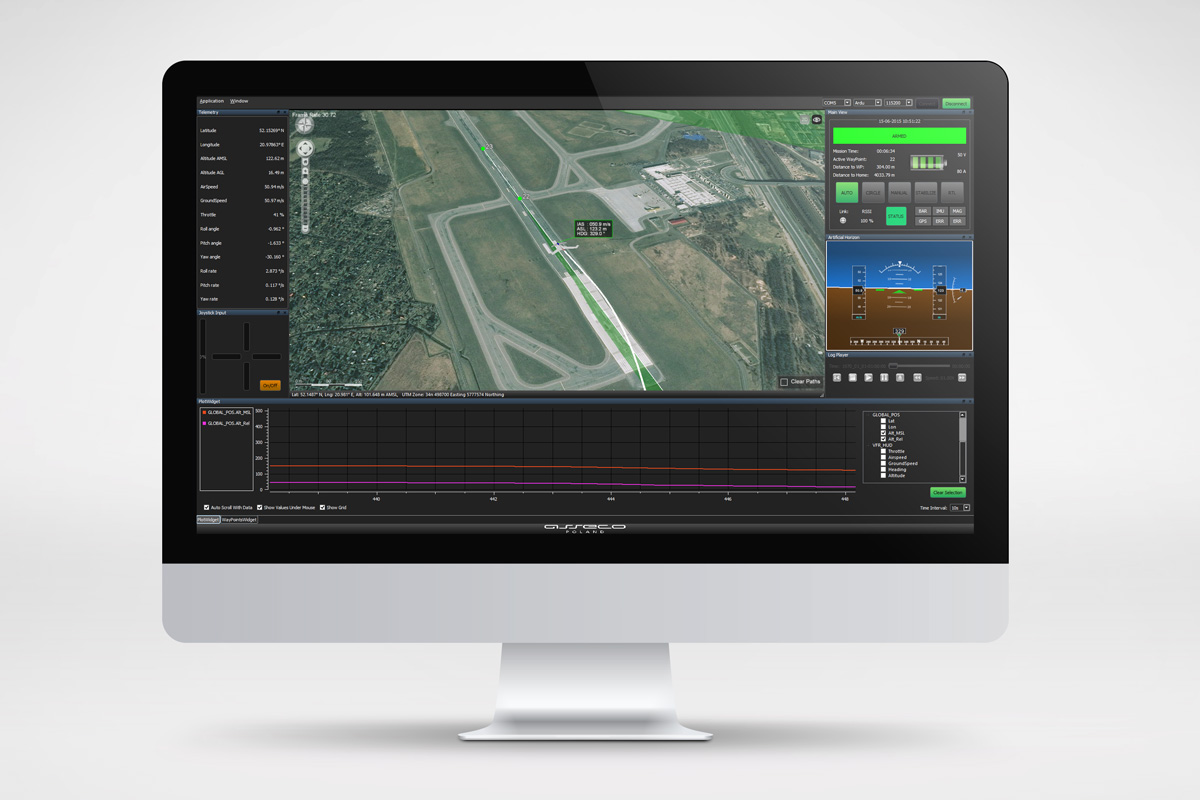
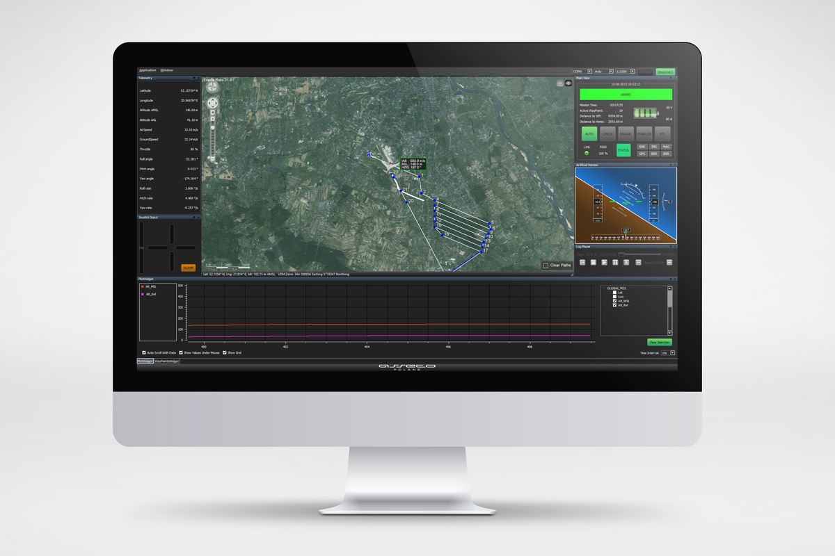
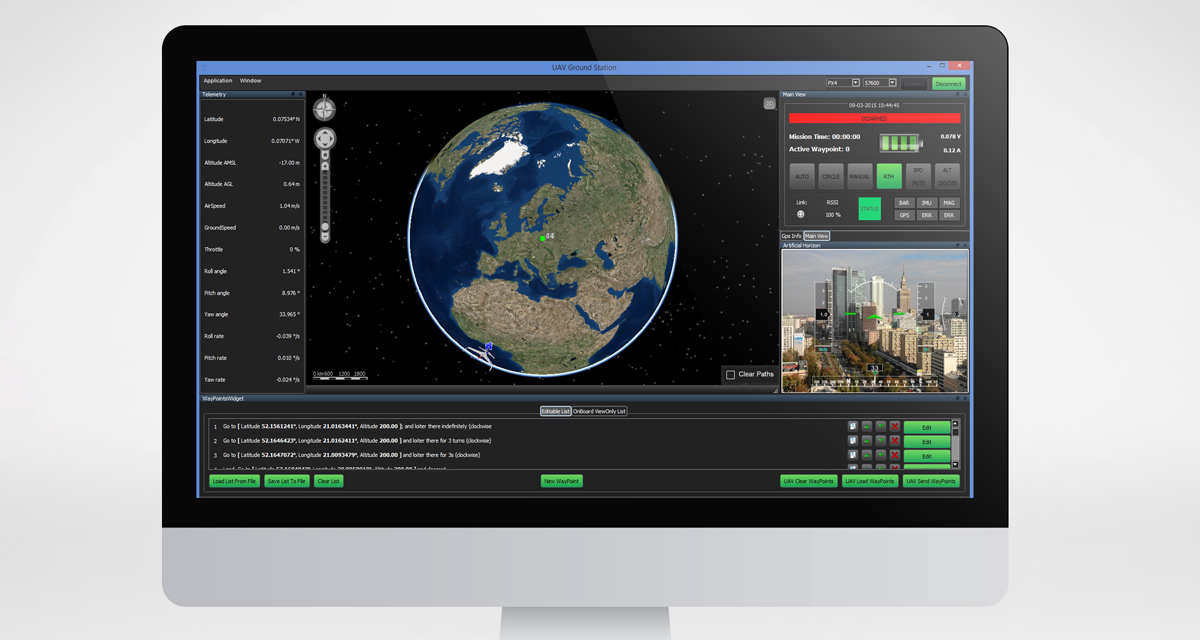
Map module contains embedded layer configuration tool allowing for any layer modifications, translucency setting, self-defined polygons and areas generation. Mission waypoints generation can be done by use of 2D or 3D interface. All mission waypoints may be moved during the mission progress. Both, on board (autopilot) and GCS mission plans are stored separately and may be synchronized in any time. Asseco GCS software supports any autopilot and payload functionalities needed for proper mission execution.
Map module contains embedded layer configuration tool allowing for any layer modifications, translucency setting, self-defined polygons and areas generation. Mission waypoints generation can be done by use of 2D or 3D interface. All mission waypoints may be moved during the mission progress. Both, on board (autopilot) and GCS mission plans are stored separately and may be synchronized in any time. Asseco GCS software supports any autopilot and payload functionalities needed for proper mission execution.
NATO Standard Interface of the Unmanned Control a System (UCS) Unmanned Aerial Vehicle (UAV) interoperability. It includes data link, command and control, and human/computer interfaces.
Functionality
Core features:
advanced mission planning module
real-time telemetry data visualisation
multi-payload system control
support for WMS, WFS, ESRI REST, SHaPefiles and other map formats
2D/3D view modes
movable waypoints during the mission progress
mission plans can be saved/loaded/edited
open-window architecture
optimal Complete Terrain Coverage path planning
photogrammetric mission planning tools
E&R procedures editor
multiscreen support
flexible licensing mechanism
OS and hardware platform independent
database backup
automatic photogrammetry mission post processing and map generation with Menci APS software
Mission planning:
editOnly (editor) & ViewOnly (onBoard) Modes
definable home location
movable waypoints during the mission progress
waypoints multi action assignment
mission plans can be saved/loaded/edited
user friendly operations on waypoints (adding, editing, moving, swaping etc.)
optimal Complete Terrain Coverage path planning
photogrammetric mission planning tools
Payload features:
multi-payload system control
video streaming or picture support
geotagging
displaying payload data on map
scene, static or moving object „auto tracking”
navigation camera support
Gallery
Contact
We invite you to reach out to our Sales Office of the Uniformed Services Solutions Division.
Asseco Poland will deliver the Unmanned System for Long Distance Photogrammetric Missions, consisting of the proprietary Asseco GCS (Ground Control Station) software that controls two UAV platforms of a maximum takeoff mass of 25 kg. The System has been ordered by the Ministry of Science and Technology of the Lagos State in Nigeria. The project is due to be completed by December 2017. The Polish System has successfully competed against the companies from all over the world.
Asseco will deliver its portable ground control station control panel – Asseco GCS – to the Military Institute of Armament Technology. This is Asseco’s proprietary solution, dedicated to the control and supervision of operations performed by unmanned platforms of various types. Its implementation is scheduled for the end of September 2016.